Press & Media Kit
It's a Beach Day is a live-data beach conditions aggregator covering Atlantic, Pacific, Gulf, Hawaiian, and Great Lakes coasts plus the Chesapeake Bay and inland swim lakes — 500 beaches across 29 states. Independent, utility-focused. No ad networks, no affiliate links, no tracking. Free to link, cite, screenshot, or embed. If you're writing about US beaches, summer travel, water quality, or regional day trips — this is for you.
The one-paragraph pitch
Every major public beach from Cape Henry, VA up through Montauk, NY — ranked by today's live conditions. The Beach Day Score combines water temp (NOAA + NDBC offshore buoys), weather (NWS), swim advisories (Maryland Healthy Beaches / county health depts), UV, surf, and seasonal factors — answering one question: is today a beach day, and which beach is best? Updated hourly. The swim-advisory aggregator alone is worth a look — it pulls every active MDE closure and caution into a clean, readable map, which the state's own viewer can't manage.
Angles that might interest your readers
- Skip the Ocean City traffic. DC and Baltimore day-trippers drive east by default. We cover 40+ closer Bay and Eastern Shore alternatives, ranked live.
- Fossil hunting at Calvert Cliffs. Miocene shark teeth, whale bones. Low-tide windows matter — our conditions page surfaces them.
- Where the sea nettles aren't. Upper Chesapeake beaches like Betterton and Elk Neck stay freshwater-inflow dominated — fewer jellyfish, better swimming earlier.
- Wild ponies. Assateague State Park vs National Seashore — we cover both, with the dog-rules and pony-encounter differences spelled out.
- Real-time swim advisories. The advisories page aggregates MDE + county health data into a single county-grouped view — handy for "is it safe to swim?" stories.
- Dog-friendly beach guide. Off-leash dog beaches, seasonal dog bans. dog-friendly page.
Sample share cards
Every beach page has a live, auto-updating 1200×630 OG image suitable for Twitter, Facebook, iMessage, Slack, or direct embed. Three examples:
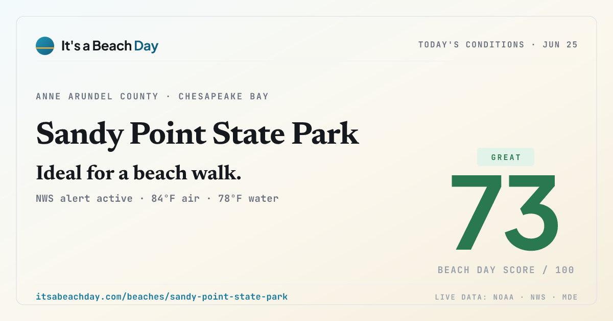
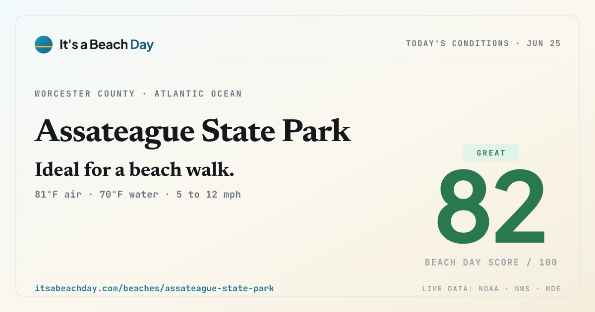
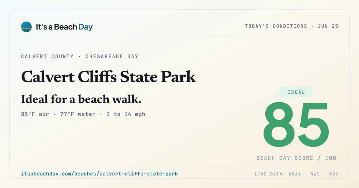
Direct image URLs (1200×630 PNG): https://itsabeachday.com/og/{slug}.png for any beach.
Data sources (for credit/context)
- NOAA CO-OPS — tides, water temperature
- National Weather Service API — forecasts, current conditions, alerts
- Maryland Healthy Beaches (MDE) + individual county health departments — swim advisories
- NOAA NDBC — offshore buoys for wave height
Full source list: /data-sources/.
Usage
You may:
- Link to any page or share card
- Screenshot or embed share cards in articles, tweets, broadcast graphics
- Cite the site as It's a Beach Day (itsabeachday.com)
- Reach out for custom data feeds, co-branded widgets, or feature requests
Contact
[email protected]
Happy to provide quotes, background, or a beach-of-the-day feed for your outlet.
Independent, utility-focused. No ad networks, no affiliate links, no tracking. Built to answer one question: Is today a beach day?